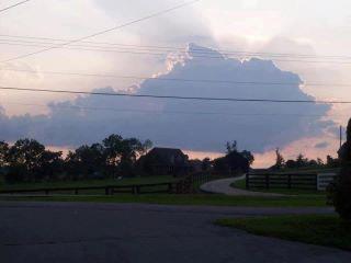
Usually when you are looking up at the clouds and seeing different shapes and things, you are really pushing your imagination. However, take a look at the picture below. It was shared by a Facebook friend and it doesn’t take much of an imagination to trace out the Bluegrass State of Kentucky in the cloud.
Pretty cool!
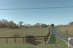
UPDATE: check out the comments below by Carl Williams. You can go to gMaps and try your hand at cyber-sleuthing. Below is the picture I frame-grabbed from google maps and they appear to match up, especially if the picture was taken in the driveway of the animal clinic (which google maps doesn’t have a vantage point of). Even the number of power lines match up.
…..Dan at aslowerpace dot net


Carl Williams says:
This photo was taken by my brother, Tony Williams, in the parking lot of his business on hwy 25 just outside of Georgetown Ky. If you search for Thunder Vallies Animal House in Georgetown Ky.on Google Maps, then go to street view and look at the other side of the road. You will see the houses in the picure.
August 12, 2012, 6:21 pmCarl Williams says:
The picture was taken in 2009.
August 12, 2012, 6:22 pmDan says:
Hi Carl…..thanks for the more detailed information. Great picture!
…..Dan
August 13, 2012, 3:19 pm